Every great city has a boulevard that defines it — the Champs-Elysees, the Ringstrasse, Unter den Linden. Mexico City’s is Paseo de la Reforma, a 15-kilometer avenue that runs from the western edge of Chapultepec Park through the financial district to the Historic Center, collecting monuments, skyscrapers, embassies, and over a century of Mexican ambition along the way.
It started as a private road for an Austrian empress. Today it’s where the city puts its best face forward — and where it goes to celebrate, protest, cycle on Sunday mornings, and sit in truly spectacular traffic the rest of the week. If you spend more than a day in Mexico City, you’ll cross Reforma at some point. Understanding the avenue means understanding the city’s geography.
From Imperial Road to National Boulevard
In 1865, Empress Carlota (wife of the ill-fated Emperor Maximilian, installed by Napoleon III) wanted a road connecting the Castle of Chapultepec to downtown. She commissioned Austrian engineer Allois Bollan Kuhmackl to build it. Originally called Paseo de la Emperatriz (Empress’s Promenade), it was meant exclusively for imperial use — because nothing says “we’re governing for the people” like a private highway.
When the Republican forces overthrew Maximilian in 1867 (and executed him), the road was briefly renamed Paseo Degollado before receiving its current name. President Lerdo de Tejada widened it and opened it to the public in 1877, modelling it on the grand European boulevards that Mexican elites admired. He planted double rows of trees, added benches, and created a promenade that for the first time gave Mexico City something resembling Parisian grandeur.
Under Porfirio Diaz (who governed Mexico from 1876 to 1911 with varying degrees of authoritarianism), Reforma became the national showcase. Monuments went up, wealthy families built mansions along its length, and the avenue became the spine of the city’s westward expansion. The neighborhoods that grew up around it — Colonia Juarez, Condesa, Roma — became the most fashionable addresses in the country.
The Glorietas: A Monument Tour on Foot
Reforma’s most distinctive feature is its series of glorietas (traffic circles), each centered on a monument. Walking the avenue from east to west is essentially a timeline of Mexican national mythology. Here are the major ones:
Glorieta de Cuauhtemoc
Near the eastern end of the avenue, a statue of Cuauhtemoc — the last Aztec emperor, who resisted the Spanish conquest — stands on an ornate pedestal decorated with carved jaguars and warriors. It’s the starting point for any walk along Reforma and sets the tone: Mexico remembers its pre-colonial past.
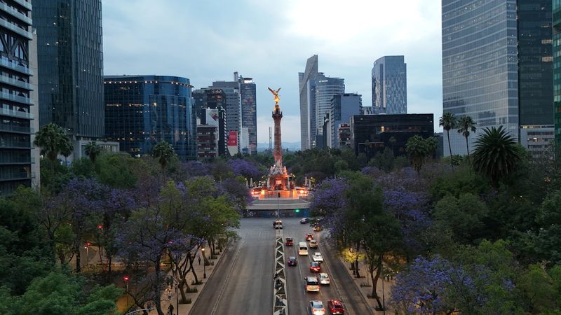
El Angel de la Independencia
The most famous monument on Reforma and arguably in all of Mexico City. The gilded Winged Victory stands 36 meters above a roundabout that doubles as the city’s unofficial gathering place for celebrations, protests, and football victories. The column also serves as a mausoleum for fourteen independence heroes. We’ve written a full guide to the Angel of Independence — it’s worth reading before you visit.
La Diana Cazadora (Diana the Huntress)
About a kilometer west of El Angel, the bronze Diana the Huntress Fountain stands in her own roundabout — a nude archer that scandalized conservative Mexico in the 1940s and had to be given a bronze loincloth until the city government finally removed it in 1992. The fountain and its turbulent history of censorship and liberation make it one of Reforma’s more entertaining stops.
Estela de Luz
Heading further west, the Estela de Luz (Pillar of Light) is a modern monument built for the 2010 bicentennial. It’s essentially a 104-meter quartz-clad tower that was massively over budget and finished late. Locals tend to regard it with resigned amusement rather than civic pride, but it photographs well at night when illuminated.
Puerta de los Leones (Chapultepec Entrance)
At the western end of Reforma’s central stretch, the monumental entrance to Chapultepec Park features lion sculptures and marks the transition from avenue to forest. Through the gates lies one of the largest urban parks in the Western Hemisphere, containing Chapultepec Castle, the National Anthropology Museum, and several other major museums.
The Modern Financial District
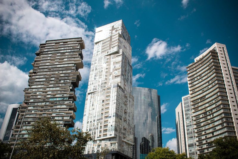
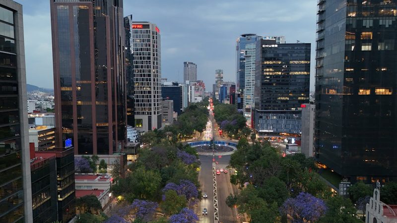
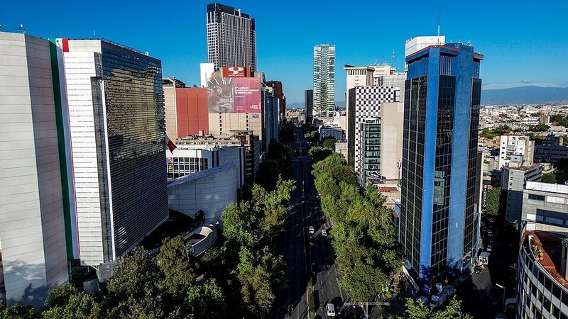
The stretch of Reforma between the Angel and Chapultepec has transformed dramatically in the 21st century. Where once there were mansions and low-rise buildings, glass towers now line both sides — the BBVA Tower, Torre Reforma (one of the tallest in Latin America), and the HSBC headquarters among them.
This is Mexico City’s corporate center. During weekday rush hours, the sidewalks fill with office workers, the Starbucks locations multiply beyond counting, and traffic becomes an exercise in patience or philosophical acceptance, depending on your temperament. The embassies of the US, UK, and several other countries sit along this stretch, adding security checkpoints to the general congestion.
The contrast with the avenue’s quieter western end, near Chapultepec, is stark. Same road, completely different energy.
Reforma on Sunday
Every Sunday morning (roughly 7 AM to 2 PM), a stretch of Reforma closes to cars and opens to cyclists, runners, skaters, and pedestrians. Thousands of people take over the avenue — families on bikes, serious road cyclists in full kit, joggers weaving between them, and food vendors setting up along the medians.
It’s one of the best things about Mexico City. An avenue that’s normally choked with cars becomes a linear park, and the atmosphere is genuinely joyful. You can rent bikes from EcoBici stations along the route or just walk. The stretch from Chapultepec to the Angel is about 3 kilometers and makes for an excellent morning stroll with coffee in hand.
If you’re visiting Mexico City and your trip includes a Sunday, don’t miss this. It reveals a side of the city — relaxed, communal, outdoors — that you won’t see during the weekday traffic grind.
What’s Along the Way
Using Reforma as a walking spine, you can reach most of Mexico City’s major attractions without ever getting lost.
Eastern end → Historic Center: Reforma feeds into Avenida Juarez, which leads directly to Alameda Central, the Palace of Fine Arts, and eventually the Zocalo. The transition from modern avenue to colonial center happens gradually over about 2 kilometers.
South of Reforma (central section): Colonia Juarez and the Zona Rosa are immediately south of the Angel. Further south, across Avenida Chapultepec, Roma Norte and Condesa begin — the city’s restaurant and cafe heartland.
North of Reforma (central section): Polanco and San Miguel Chapultepec sit north of the avenue in the Chapultepec area — upscale residential and gallery neighborhoods.
Western end: Chapultepec Castle sits on a hill visible from the avenue. The National Anthropology Museum is inside the park, a 10-minute walk from the main entrance.
Getting Along Reforma
Metro: Line 1 runs roughly parallel to Reforma, one block south. Stations at Chapultepec, Sevilla, Insurgentes, and Cuauhtemoc all put you within a 5-minute walk of the avenue. This is the fastest way to traverse it.
Metrobus: Line 1 runs on Insurgentes, crossing Reforma at the Glorieta de los Insurgentes. Useful for north-south connections.
Turibus: The hop-on-hop-off tourist bus runs along Reforma on its Historic Center circuit, with stops at the major monuments. It’s not fast, but it gives you a narrated overview.
Walking: The full stretch from the Chapultepec entrance to the Angel is about 3 kilometers — a pleasant 40-minute walk with wide sidewalks and monuments to break up the distance. Continuing east to the Historic Center adds another 2 kilometers.
EcoBici: Bike-share stations are plentiful along Reforma. On weekdays, a protected bike lane runs along parts of the avenue. On Sundays, you have the whole road.
Driving: Don’t, unless you absolutely must. Rush hour on Reforma is legendary for all the wrong reasons.
Reforma at Night
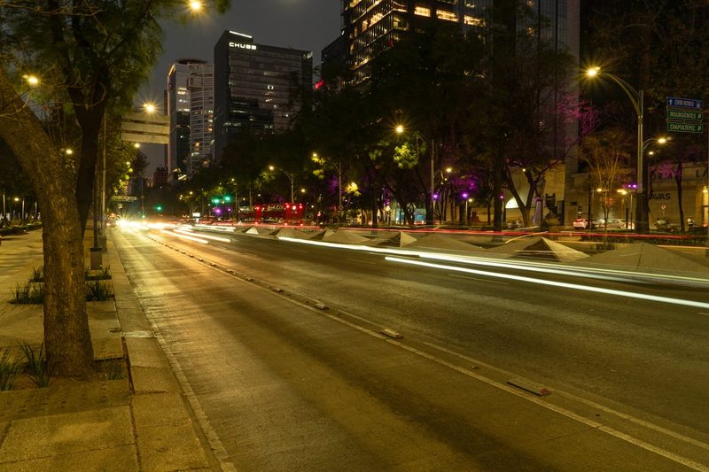
The avenue transforms after dark. The Angel is floodlit in gold, the Diana Fountain is illuminated, and the glass towers along the corporate stretch glow against the night sky. The Estela de Luz changes colors. If you’re going to walk Reforma for the views, evening is the time.
The western stretch near Chapultepec gets quieter at night, while the central section around the Angel and Zona Rosa picks up energy as the restaurants and bars in Colonia Juarez come alive. It’s a different avenue depending on the hour.
More Than an Avenue
Paseo de la Reforma is the closest thing Mexico City has to a through-line — literally and figuratively. It connects the pre-colonial past (Chapultepec, which the Aztecs used as a retreat) to the colonial center, passing through every era of Mexican history along the way. The monuments aren’t just decorative; they’re a deliberately constructed national narrative in bronze and stone.
Walk it once, slowly. You’ll understand the city’s layout better than any map could teach you. And if you happen to be here on a Sunday morning, take a bike and ride the whole thing while the city is quiet and the mountains are visible through the smog. That’s Reforma at its best.