
Reviewed · HIKING & TREKKING
Trekking Through The Volcanoes
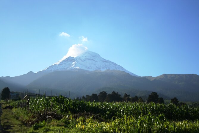
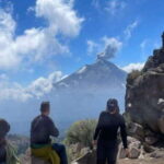
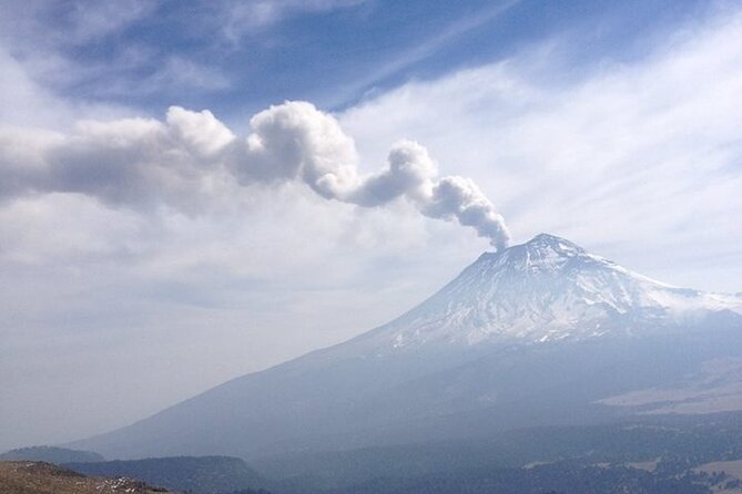
The real draw here is the chance to walk between Iztaccíhuatl and Popocatépetl, two of Mexico’s great volcanoes, without signing up for a technical climb. You start high in the national park, pass through pine forest and open mountain country, and may see Popocatépetl’s fumarole rising in the distance.
In This Article
- Key points to know
- Walking between Mexico’s two great volcanoes
- From Condesa to Paso de Cortés
- Cerro Altzomoni and the view toward Popocatépetl
- Down through Amalacaxco Ravine
- Choosing the 9 or 13 kilometer route
- What you get in the backpack
- Tacos after the trail
- Is the $133.34 price fair?
- Who should book this mountain day?
- Should you book Trekking Through The Volcanoes?
- FAQ
- Where does the tour start?
- What time does the tour begin?
- Where does the tour end?
- How long does the tour last?
- How far is the hike?
- What volcanoes will I see?
- Is lunch included?
- Are trekking poles provided?
- Is the tour conducted in English?
- Can I cancel for a refund?
I like the small-group format, capped at 13 people, and the fact that trekking poles, a backpack, food, and drinks are supplied. I also like the finish at a traditional market, where tacos and quesadillas make a much better post-hike meal than a packaged sandwich. The catch is altitude: this is a long walk at roughly 3,500 to 4,000 meters, and the thin air can make a moderate trail feel strenuous.
Key points to know
- The route links two famous volcanoes: You walk below Iztaccíhuatl and active Popocatépetl, with views of peaks, fumaroles, forests, and mountain valleys.
- Expect a high-altitude hike: The trail is not a technical ascent, but steep sections, loose ash, dust, and thin air demand decent fitness.
- You can walk about 9 or 13 kilometers: The longer loop gives you more scenery and is the better choice if your group has the energy.
- Carlos, Bernardo, Alan, and other guides lead the outings: The strongest guides check your pace, explain the terrain, and help anyone struggling with the altitude.
- Lunch is part of the day: Your pack includes water, an energy drink, snacks, and food, followed by Mexican tacos and quesadillas at a traditional roadside market.
- Plan for a long day: Pickup is at 7 a.m. in Condesa, the drive takes about two hours each way, and the full outing can run beyond nine hours.
Walking between Mexico’s two great volcanoes
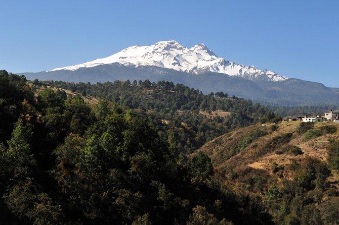
This is not a summit expedition. You will not climb to the top of either volcano. Instead, the route explores the lower slopes and high country between them, offering a close look at the volcanic terrain without the demands of a multi-day climb.
I find that a good day outside Mexico City should give you more than a change of scenery. This trip does. You trade city traffic and concrete for pine woods, alpine grasslands, ravines, glacial water, and long views toward some of the country’s best-known peaks.
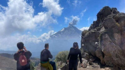
Popocatépetl is still active, so its fumarole can sometimes be seen from the route. That sight depends on weather and visibility, and you should not book this expecting a guaranteed volcanic display. On a clear day, though, the combination of the smoking cone, Iztaccíhuatl’s snowy or glaciated upper slopes, and the open mountain views can be striking.
The route has a feeling of being far from the city, but you do not need to organize a remote mountain trip on your own. México Travesías handles the transport, route, equipment, guides, and food in one day.
Other hiking tours in Mexico City
From Condesa to Paso de Cortés
The day begins at 7 a.m. at Av. Vicente Suárez 38 in Colonia Condesa. Private transport takes you out of Mexico City toward Iztaccíhuatl-Popocatépetl National Park.
Allow for a long ride. The trip to the mountain area takes about two hours, and the winding roads may bother you if you are prone to motion sickness. A restroom stop is made during the drive, but facilities at the trailhead and along the route are limited. Bring toilet paper and some cash for bathroom access.
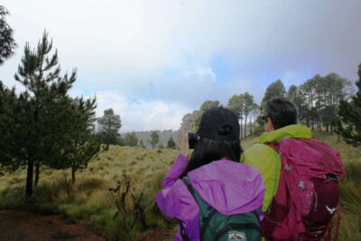
Paso de Cortés is the starting point. From here, the route heads through forest with Iztaccíhuatl in front of you. The elevation is already high when you begin, which is why the first part may feel harder than the distance suggests.
Your guide should set the pace and keep an eye on how everyone is doing. Carlos, Bernardo, Alan, Alberto, Sergio, and Salva are among the guides named by people who took the outing. The best part of the guiding is practical: regular stops, help with pacing, answers to questions, and support for anyone who needs extra time.
Guiding style can vary. Some guides provide plenty of information about the volcanoes, plants, animals, and geography. Others focus more on leading the group and answering questions when asked. If you want a nature lesson, ask questions early rather than waiting for a running commentary.
Cerro Altzomoni and the view toward Popocatépetl
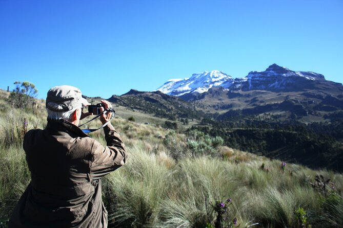
The route climbs toward Cerro Altzomoni, one of the best points for seeing Popocatépetl and its fumarole. This is one of the strongest sections of the outing because the scenery opens up as you gain height.
The climb is not described as a technical one, but it is not a casual stroll either. Reports put the total walk anywhere from about 9 to 13 kilometers, with roughly 300 to 400 meters of ascent. Some groups complete the hike in around five hours, with the rest of the day taken up by transport, stops, and lunch.
The altitude is the main challenge. Some descriptions place the route near 13,000 feet, while other accounts refer to starting points around 3,500 meters and finishing below 4,000 meters. The exact figure can vary by route, but the useful advice is the same: you will be walking high above Mexico City.
You may notice shortness of breath on uphill sections even if you are fit at home. One person who had recently arrived in Mexico City found the elevation difficult, while someone who had spent several days acclimatizing felt more comfortable. That is a good reason to spend some time in Mexico City before booking this hike, if your schedule allows.
The supplied poles help on climbs and descents, especially where the ground is loose. Use them. They are not decorative equipment, and they can make a real difference on slippery or dusty sections.
Down through Amalacaxco Ravine
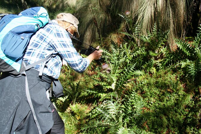
After the high point, the route descends toward Amalacaxco Ravine. This gives the walk more variety than a simple out-and-back trail. You move through forest, open slopes, and rougher volcanic ground, with chances to see local plants and perhaps wildlife.
The trail is often a dirt road or broad mountain path rather than a narrow footpath. That makes navigation easier, but it does not remove the physical work. Some stretches are steep, dusty, or covered in loose volcanic ash. The ash can rise around your feet, so a bandanna or other face covering is useful, especially on a dry day.
Several accounts describe a waterfall or glacial stream along the route. In colder weather, icicles may form around the water and nearby plants. This is an especially memorable detail because it shows how quickly conditions change at high altitude. You might begin in cold morning air, warm up during the climb, and finish in much milder conditions.
The trail can also be quiet. One weekday group saw only one other group during the hike. That peace is part of the appeal, though the route is not untouched wilderness in the strict sense. One section near the end may use a road with passing cars, and that final stretch is less pleasant than the forest and mountain paths.
Choosing the 9 or 13 kilometer route
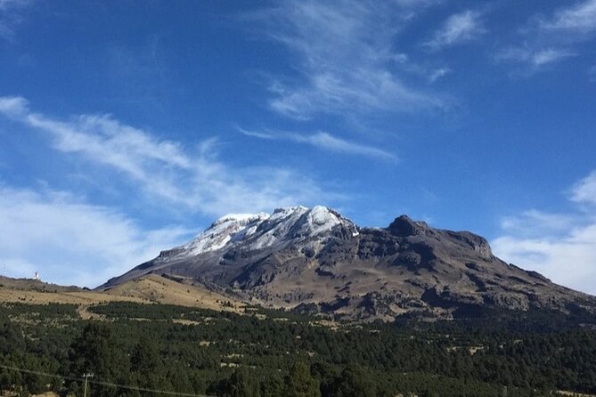
The outing may offer a choice between a shorter route of about 9 kilometers and a longer loop of roughly 13 kilometers. The long loop adds time and effort, but it also gives you more of the open mountain scenery and is often described as the favorite part of the walk.
I would choose the 13-kilometer option if you regularly hike and your body is handling the altitude well. If you are unsure, the shorter route is the sensible choice. The guides can adjust the pace and help people complete the route, but you should not treat that flexibility as a substitute for fitness.
This is best called an intermediate hike. The paths are generally manageable, yet the combination of distance, elevation, steep uphill sections, heat, dust, and thin air can be demanding. You should be comfortable walking uphill for sustained stretches and spending several hours on your feet.
The group limit of 13 is useful here. A smaller group lets the guides keep track of different walking speeds and makes it easier to stop for photos or breathing breaks. Some departures have included more people than the stated limit, so confirm the current group size when booking if that matters to you.

What you get in the backpack
The company provides trekking poles and a backpack. The pack includes lunch supplies and drinks, so you do not need to carry a full day’s food from Mexico City.
The listed food and drinks include:
- One liter of water
- A 600-milliliter energy drink
- A chocolate energy bar
- Peanuts
- A fruit snack
- A sandwich or Mexican-style packed food, depending on the departure
The exact snack selection can vary, but the amount has generally been enough to keep people going through a long morning. You will also eat a proper Mexican meal after the hike, so the packed food is fuel rather than the main culinary event.
Wear hiking boots or sturdy shoes with good grip. Bring sunglasses, a hat, sunscreen, and layers. Morning conditions can be around 8 degrees Celsius, with wind making it feel colder. Later, after several hours of walking, you may be comfortable in much lighter clothing.
A warm jacket is important even if the forecast for Mexico City looks mild. Mountain weather is different, and rainy-season conditions can reduce visibility. A rain jacket may be useful depending on the date, but layers are the safest general choice.
Tacos after the trail
The post-hike meal is one of the tour’s best touches. On the way back toward Mexico City, the group stops at a traditional market or roadside Mexican food stand for tacos and quesadillas.
This is more than a convenient meal. After several hours at altitude, sitting down for hot local food gives the day a satisfying finish. Squash flower tacos have been a particular favorite, and the menu offers more character than a standard tourist lunch.
The timing is usually around the early afternoon, though the full schedule depends on the pace of the group and the drive. You should expect to be hungry by then, so use the snacks and water in your pack rather than saving everything for the market.
Is the $133.34 price fair?
At $133.34 per person, the price is reasonable if you want a full-service mountain day from Mexico City. You are paying for private transportation, a guide, trekking poles, a backpack, packed food, drinks, and the restaurant-style Mexican lunch.
The drive alone would be awkward and time-consuming to arrange independently, especially if you do not have a car. The equipment also matters. Renting or buying poles, planning the route, carrying enough water, and finding the national park access points would reduce the apparent savings of going alone.
The value is strongest for solo visitors and small parties who want a guided outing without arranging every detail. It is less compelling if you already have transport, mountain equipment, and experience hiking at this altitude.
The tour is recommended by 95 percent of customers and has a 4.8 rating from 96 reviews. Those numbers suggest a reliable experience, but they should not hide the physical demands. The most common praise goes to the scenery, the organization, the food, and guides who actively monitor the group. The main complaints concern quiet guiding, the dusty trail, the road section near the end, and an occasional poor first interaction.
Free cancellation is available up to 24 hours before the 7 a.m. start time. Cancellations or changes inside that window are not refunded, and bad weather or failure to reach the minimum group size can lead to a new date or a full refund.
Who should book this mountain day?
I would recommend it to fit visitors who want a serious day outdoors but do not want to summit a volcano. It is also a good choice if you have already seen Mexico City’s museums and neighborhoods and want a sharp change of pace.
You will get the most from it if you:
- Have experience with long walks or day hikes
- Have spent enough time in Mexico City to begin adjusting to the altitude
- Enjoy mountain scenery more than a packed sightseeing schedule
- Are comfortable with dust, uneven ground, and changing weather
- Want a guide and transport rather than a self-planned outing
I would think twice if you have altitude problems, dislike long drives, or expect a gentle park walk. Children and less fit members of a group may finish, but the hike can still be tough for them. Tell the guide early if you need a slower pace or extra breaks.
Should you book Trekking Through The Volcanoes?
Yes, if your idea of a good Mexico City side trip includes thin air, big volcano views, dusty boots, and tacos afterward. The route offers a rare look at the high country around Iztaccíhuatl and Popocatépetl, with enough variety to keep the walk interesting.
Book it with realistic expectations. You are not climbing a volcano summit, and the drive takes much of the day. The trail can be strenuous at altitude, the weather may hide the peaks, and the final road section is less scenic than the rest.
Choose the long loop only if you are comfortable with the distance and elevation. Bring layers, sturdy shoes, sunglasses, water-ready habits, and something to cover your mouth in dusty conditions. If that sounds like your kind of day, this is a well-organized way to leave the city behind and get close to Mexico’s volcanic country.
FAQ
Where does the tour start?
The tour starts at Av. Vicente Suárez 38 in Colonia Condesa, Cuauhtémoc, Mexico City.
What time does the tour begin?
The scheduled start time is 7:00 a.m.
Where does the tour end?
The activity ends back at the starting meeting point in Mexico City.
How long does the tour last?
The listed duration is approximately nine hours. The full day may last a little longer, depending on the drive, hiking pace, stops, and lunch.
How far is the hike?
The route may be about 9 or 13 kilometers, depending on the option selected and the group’s plans.
What volcanoes will I see?
The route travels between Iztaccíhuatl and Popocatépetl. Popocatépetl is an active volcano, and you may see its fumarole if conditions are clear.
Is lunch included?
Yes. The package includes packed food and drinks during the hike, followed by tacos and quesadillas at a traditional market or roadside Mexican food stop.
Are trekking poles provided?
Yes. Trekking poles and a backpack are provided for the hike.
Is the tour conducted in English?
Yes. The experience is offered in English.
Can I cancel for a refund?
You can cancel at least 24 hours before the start time for a full refund. Cancellations or changes made less than 24 hours before the start time are not refunded.
More Hiking & Trekking Tours in Mexico City
More tours in Mexico City we've reviewed


Hiking & Trekking, compared.
 ★ 4.0Iztaccihuatl Volcano Hike with an AlpinistFrom $13911 hours (approx.)
 ★ 4.7Mexico City: Guided Volcano Trek with LunchFrom $1059 hours
 ★ 4.3From Mexico City: Hike Iztaccihuatl Volcano with an AlpinistFrom $16811 hours
 ★ 5.0Hike at Nevado de Toluca VolcanoFrom $10512 hours (approx.)
 ★ 5.03 Hour Private Hike: Mountain Nevado Toluca from Mexico CityFrom $1179 hours (approx.)
 ★ 5.0Sunrise in Las Alturas Hiking in El Pico del Aguila TlalpanFrom $1078 hours (approx.)
 ★ 4.9From Mexico City: 2-Day Pico de Orizaba Summit TrekFrom $5992 days
 ★ 5.0Hiking to the Puerta del Cielo Viewpoint in Mexico CityFrom $956 hours (approx.)
The lists this tour appears in